
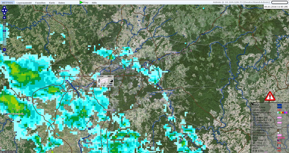
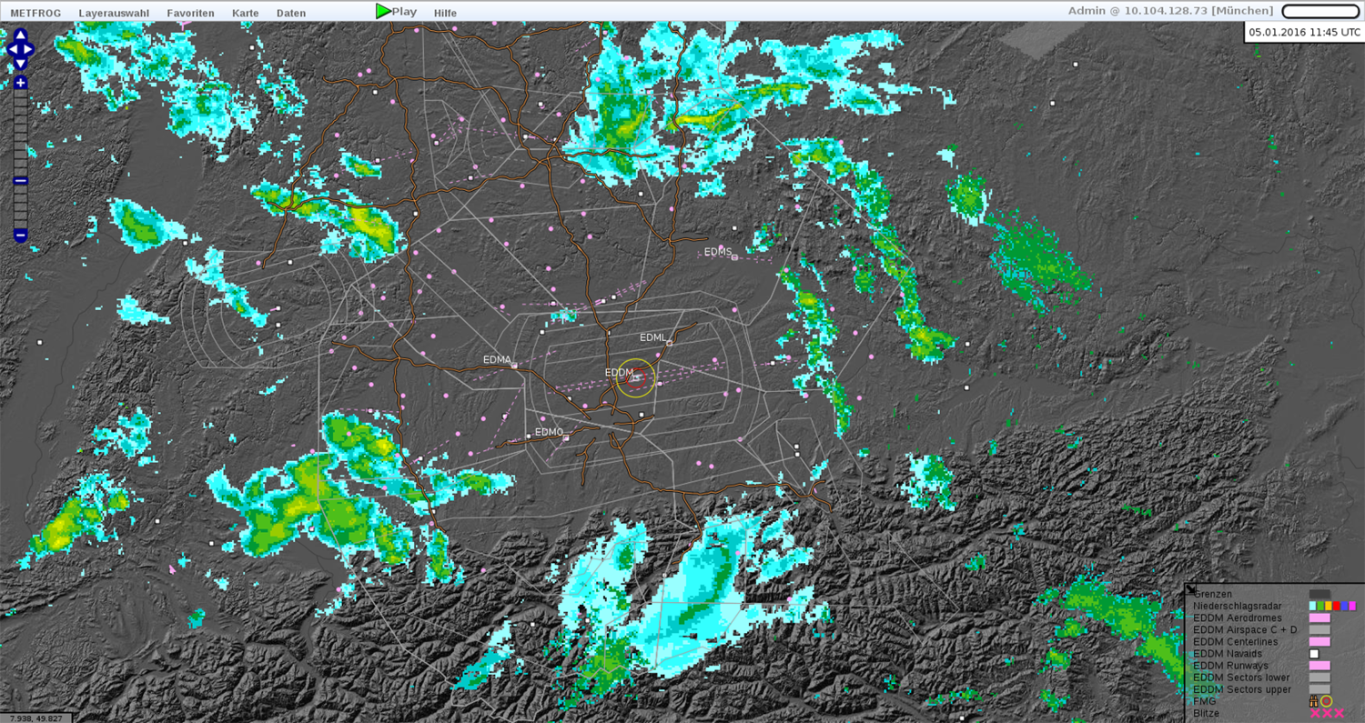
Highly sophisticated technology to guide aircraft safely through German airspace.
METFROG
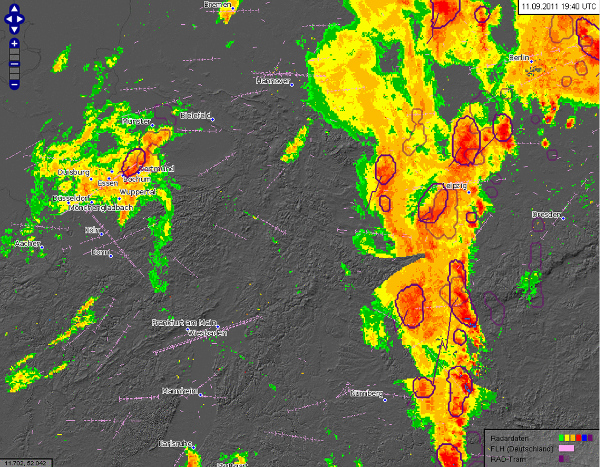
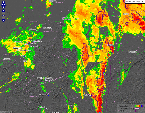
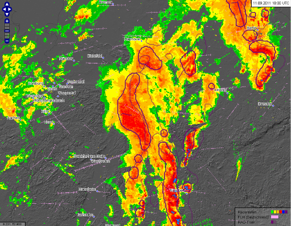
Since 2008 ‘ask’ has contributed to the design, development and commissioning of software solutions for German Air Traffic Control. We also provide software maintenance and quality assurance services. METFROG is one of the software solutions we have delivered. It lets DFS perform air traffic control safely and efficiently by harnessing weather information from the German Weather Service DWD for flight planning and control.
METFROG uses highly sophisticated technology to display weather information. METFROG has been used since 2010 to guide aircraft safely through German airspace at the DFS control centres in Langen, Bremen, Karlsruhe and Munich. It’s also used within the control towers of 16 German international airports to ensure that their air traffic is handled safely and punctually.
Another ‘ask’ solution for DFS is the WTQ (Wind, Temperature, QNH) Service. It’s an application which manages and processes incoming weather data. It performs data transformation and supplies the DFS end-systems ATCISS and P1/VAFORIT with their expected data input formats.
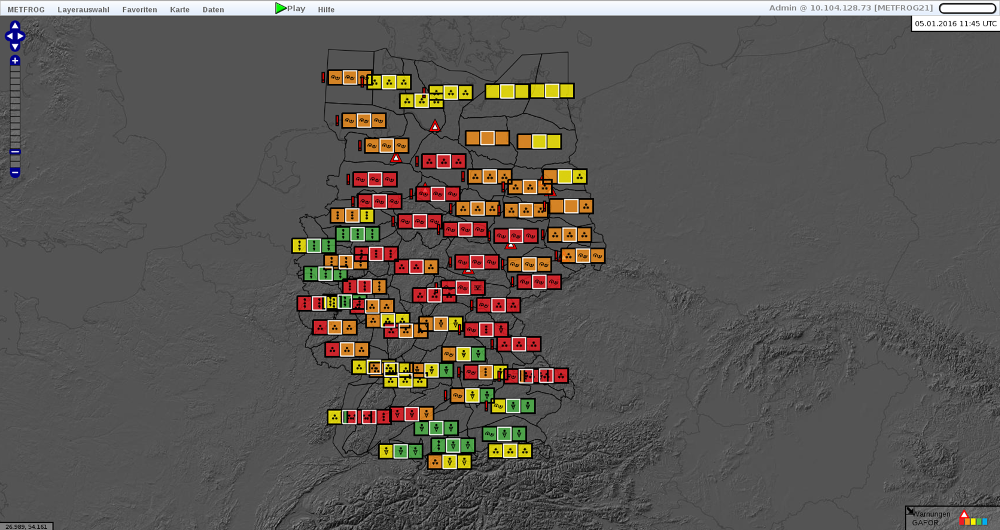

METFROG INPUT
- Radar FABEC (HDF)
- Satellite Images (GeoTIFF)
- Lightning (XML)
- NowCastMix (XML)
- Nowcast (XML)
- NOTAMS (ASCII)
- METAR / SPECI (ASCII)
- DWD Airport warnings
- Wind warning (LLWAS and CAP)
- Wind forecast (GRIB2)
METFROG MAPS
- Simplified background map
- 15 meter satellite textures
- OpenStreetMaps
- Airport information (runway and runway centre line)
- NAV Aids
- Sectors
- Landing fields (small airports)
- Motorways