Stay One Step Ahead with trivisWS.

trivisWS provides a new, lightweight, browser-based weather information system for our customers in air traffic control, construction, media, insurance and elsewhere. trivisWS is based on state-of-the-art web technologies and meets OGC-compliant standards. Combined with its service-oriented architecture, trivisWS guarantees a flexibly deployable and highly maintainable future-proof system. trivisWS is available for local hosting or offered via software-as-a-service.
The software solution is hosted by the client on their own infrastructure; it’s freely user-configurable and expandable.The service solution is managed in the cloud by ‘ask’; users are granted access via the internet. As a result, customers can access trivisWS easily via their mobile or desktop to retrieve the latest weather information.
The weather data within trivisWS comes from a variety of qualified sources. This can include the most recent observations and radar data from the DWD, EUMETSAT satellite images or KNMI precipitation estimates. Prediction data from GFS, ICON, COSMO and MOSMIX, as well as soil analysis maps, can be displayed. The DWD Climate Data Center offers a data catalogue of past decades’ weather information. This invaluable resource allows customers to archive their own weather data, granting them unlimited access for later visualization and analysis.
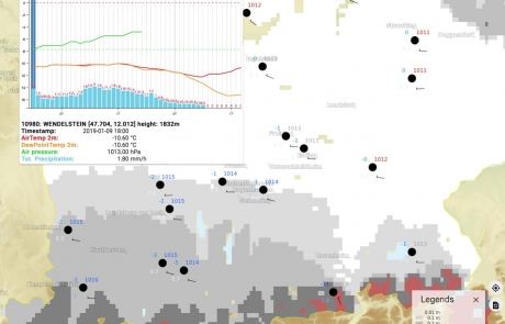
trivisWS provides customers a great variety of weather data visualization possibilities. It offers a layer-based weather map with free location and time selection options. trivisWS lets users interactively pick values or select weather stations and display data. Downloadable meteograms in time series can be shown. If required, data can be presented in tabular form for quick search and processing.


